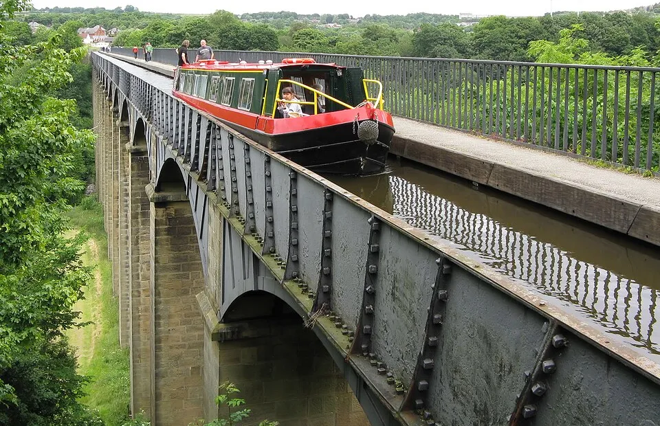
Pontcysyllte Aqueduct
Photo via Wikimedia Commons — licence & author.
'The stream in the sky' — World Heritage
This is a quick reference, not a full walked guide. The facts below — location, parking, grid reference and access — are maintained from our dataset, but we haven't published our own first-hand write-up of Pontcysyllte Aqueduct yet. Know it well? Help us get it right.
Thomas Telford's masterpiece of 1805 — a cast-iron aqueduct carrying the Llangollen Canal 38 metres above the River Dee on nineteen soaring arches, the tallest canal aqueduct ever built and now a World Heritage Site. You can walk the towpath across for free at any time (there's a handrail on one side only — not one for vertigo sufferers), or, for the full thrill, paddle a canoe across the 'stream in the sky' with a local hire outfit. Unforgettable either way.
Getting there
Pontcysyllte Aqueduct is in Llangollen, Dee Valley & the Berwyn. It's roughly 13 min (3.4 miles) from Llangollen , and within reach of Corwen (35 min) and Ruthin (39 min).
The nearest parking: Trevor Basin visitor car park. Grid reference SJ 271 421 — works on any OS map and doesn't need a phone signal.
Good to know
Walk across free anytime; book a canoe/kayak crossing with local hire outfits for the full thrill.
🌟 Best time: Canoe crossings of the stream in the sky — around June–August.
On the map
View Pontcysyllte Aqueduct on OpenStreetMap ↗, or open it in the Explore Wales trip planner to add it to a day out with drive times and offline maps.
Staying over?
Llangollen makes a relaxed base for exploring the area — worth staying over to catch an early start or a golden-hour finish.
Browse places to stay near Llangollen ↗ opens Booking.com — needs signalNearby places
Make Pontcysyllte Aqueduct part of a day out
Add it to a trip in the free Explore Wales planner — chained drive times, weather, campsite suggestions, and offline maps for when the signal drops.