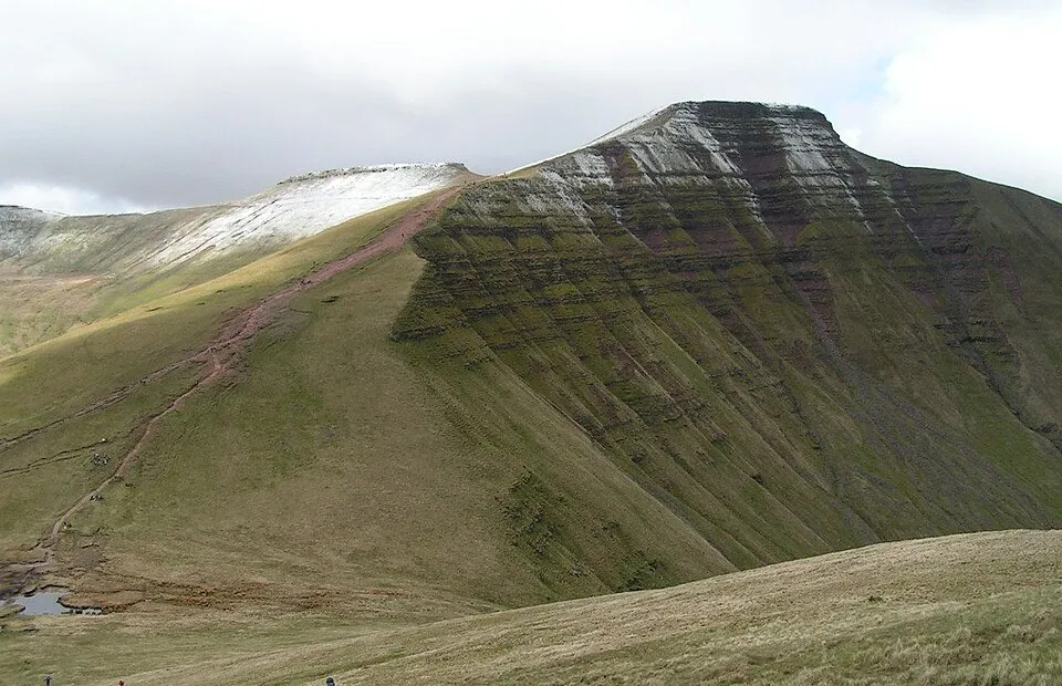
Pen y Fan
Photo via Wikimedia Commons — licence & author.
South Wales' highest peak — 886m
This is a quick reference, not a full walked guide. The facts below — location, parking, grid reference and access — are maintained from our dataset, but we haven't published our own first-hand write-up of Pen y Fan yet. Know it well? Help us get it right.
At 886 metres, the highest peak in South Wales and anywhere in Britain south of Cadair Idris — a flat-topped whaleback of Old Red Sandstone at the heart of Bannau Brycheiniog. The most popular route is the wide, eroded 'motorway' path from Pont ar Daf near the Storey Arms, a steady there-and-back of a couple of hours; a finer day links neighbouring Corn Du and Cribyn on a horseshoe. The land is cared for by the National Trust, and near the summit a small obelisk remembers Tommy Jones, a five-year-old boy who died lost on the hill in 1900. It is a genuine mountain despite the crowds, and the weather turns fast up top, so carry layers and check a forecast. Start early: the car parks fill by mid-morning on any fine weekend.
Getting there
Pen y Fan is in Bannau Brycheiniog (Brecon Beacons). It's roughly 16 min (4.8 miles) from Brecon , and within reach of Llandovery (49 min) and Caerphilly (64 min).
The nearest parking: Pont ar Daf pay-and-display on the A470. Grid reference SO 017 210 — works on any OS map and doesn't need a phone signal.
Good to know
The 'motorway' path from Pont ar Daf is the easiest (2–3 hrs return). Go early or midweek; the horseshoe via Corn Du and Cribyn is finer and quieter.
🌟 Best time: Long daylight for the Beacons horseshoe — around May–September.
On the map
View Pen y Fan on OpenStreetMap ↗, or open it in the Explore Wales trip planner to add it to a day out with drive times and offline maps.
Staying over?
Brecon makes a relaxed base for exploring the area — worth staying over to catch an early start or a golden-hour finish.
Browse places to stay near Brecon ↗ opens Booking.com — needs signalNearby places
Make Pen y Fan part of a day out
Add it to a trip in the free Explore Wales planner — chained drive times, weather, campsite suggestions, and offline maps for when the signal drops.