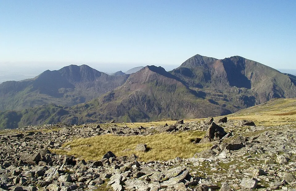
Yr Wyddfa (Snowdon)
Photo via Wikimedia Commons — licence & author.
Wales' rooftop — 1,085m
This is a quick reference, not a full walked guide. The facts below — location, parking, grid reference and access — are maintained from our dataset, but we haven't published our own first-hand write-up of Yr Wyddfa (Snowdon) yet. Know it well? Help us get it right.
The highest mountain in Wales and England at 1,085 metres, and the busiest in Britain — well over half a million people reach the top each year. Six paths climb it: the long, steady Llanberis Path; the dramatic Pyg and Miners' Tracks from Pen-y-Pass; and the quieter Rhyd Ddu, Snowdon Ranger and Watkin routes. If you'd rather ride, the Snowdon Mountain Railway has climbed by rack-and-pinion from Llanberis since 1896, ending at the Hafod Eryri visitor centre just below the summit. Pen-y-Pass parking is tiny and must be pre-booked, so most walkers use the Sherpa'r Wyddfa bus. On a clear day the view reaches Ireland; on a bad one you'll see the person in front, so check a mountain forecast before you set off.
Getting there
Yr Wyddfa (Snowdon) is in Eryri, Eryri (Snowdonia). It's roughly 14 min (3.9 miles) from Llanberis , and within reach of Beddgelert (15 min) and Capel Curig (23 min).
The nearest parking: Pen-y-Pass (pre-book!) or Nant Peris park & ride. Grid reference SH 660 554 — works on any OS map and doesn't need a phone signal.
Good to know
Pre-book Pen-y-Pass parking or use the Sherpa'r Wyddfa bus. Start by 8am. Miners' up, Pyg down is a fine loop.
On the map
View Yr Wyddfa (Snowdon) on OpenStreetMap ↗, or open it in the Explore Wales trip planner to add it to a day out with drive times and offline maps.
Staying over?
Llanberis makes a relaxed base for exploring the area — worth staying over to catch an early start or a golden-hour finish.
Browse places to stay near Llanberis ↗ opens Booking.com — needs signalNearby places
Make Yr Wyddfa (Snowdon) part of a day out
Add it to a trip in the free Explore Wales planner — chained drive times, weather, campsite suggestions, and offline maps for when the signal drops.