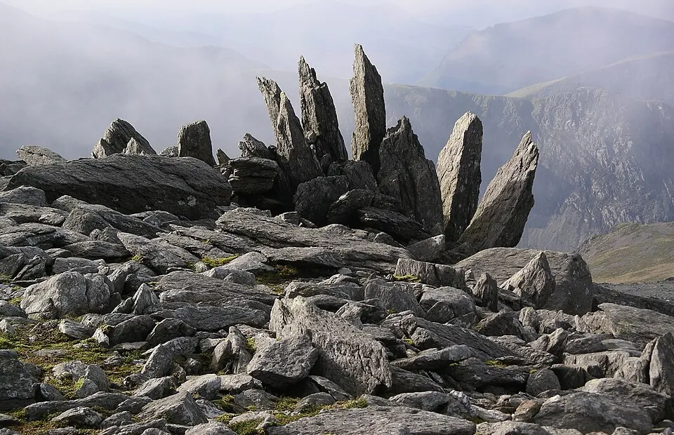
Glyderau (Glyder Fawr & Fach)
Photo via Wikimedia Commons — licence & author.
Shattered moonscape summits
This is a quick reference, not a full walked guide. The facts below — location, parking, grid reference and access — are maintained from our dataset, but we haven't published our own first-hand write-up of Glyderau (Glyder Fawr & Fach) yet. Know it well? Help us get it right.
Home to the strangest summits in Wales: the shattered rock spikes of Castell y Gwynt (the 'castle of the winds') and the astonishing Cantilever Stone, a great slab jutting into space that every walker photographs. At 1,001 metres it's a hard mountain day with an other-worldly reward. The classic round climbs from Cwm Idwal past the Devil's Kitchen, over Glyder Fawr and Glyder Fach, and descends the rocky rib of Y Gribin. Serious ground — go equipped and pick your weather.
Getting there
Glyderau (Glyder Fawr & Fach) is in Ogwen Valley, Eryri (Snowdonia). It's roughly 15 min (4.2 miles) from Llanberis , and within reach of Capel Curig (17 min) and Bethesda (18 min).
The nearest parking: Ogwen Cottage car park. Grid reference SH 648 601 — works on any OS map and doesn't need a phone signal.
Good to know
Classic route: up via Cwm Idwal & the Kitchen, over both Glyders, down Y Gribin. Photo on the Cantilever obligatory.
On the map
View Glyderau (Glyder Fawr & Fach) on OpenStreetMap ↗, or open it in the Explore Wales trip planner to add it to a day out with drive times and offline maps.
Staying over?
Llanberis makes a relaxed base for exploring the area — worth staying over to catch an early start or a golden-hour finish.
Browse places to stay near Llanberis ↗ opens Booking.com — needs signalNearby places
Make Glyderau (Glyder Fawr & Fach) part of a day out
Add it to a trip in the free Explore Wales planner — chained drive times, weather, campsite suggestions, and offline maps for when the signal drops.