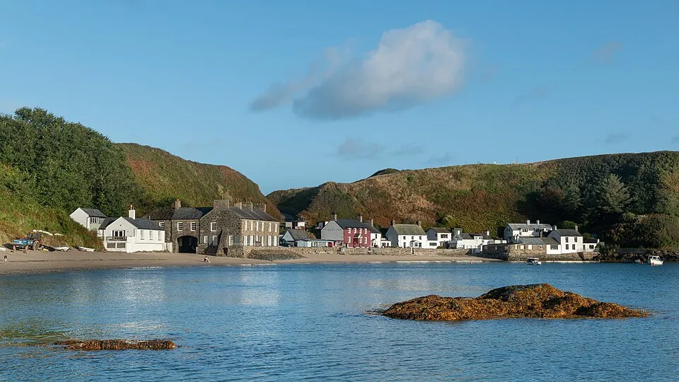
Porthdinllaen & Tŷ Coch
Photo via Wikimedia Commons — licence & author.
Paddle to a beach pub
This is a quick reference, not a full walked guide. The facts below — location, parking, grid reference and access — are maintained from our dataset, but we haven't published our own first-hand write-up of Porthdinllaen & Tŷ Coch yet. Know it well? Help us get it right.
A sheltered National Trust fishing hamlet curled around a hooked sandy bay — paddle round from Morfa Nefyn and you can land right outside Tŷ Coch, regularly named one of the best beach pubs in the world, where seals patrol the moorings. The bay is sheltered from south-westerlies, and mid-tide is the time to go. If the sea says no, you can simply walk in across the golf course. Parking is paid at Morfa Nefyn.
Getting there
Porthdinllaen & Tŷ Coch is in Morfa Nefyn, Llŷn, Llŷn Peninsula. It's roughly 9 min (1.9 miles) from Nefyn , and within reach of Pwllheli (23 min) and Abersoch (26 min).
The nearest parking: NT car park, Morfa Nefyn. Grid reference SH 285 409 — works on any OS map and doesn't need a phone signal.
Good to know
Sheltered from SW winds; go at mid-tide. Walk in via the golf course if the sea says no.
🌟 Best time: Peak season for the paddle to Tŷ Coch — around June–August.
On the map
View Porthdinllaen & Tŷ Coch on OpenStreetMap ↗, or open it in the Explore Wales trip planner to add it to a day out with drive times and offline maps.
Staying over?
Nefyn makes a relaxed base for exploring the area — worth staying over to catch an early start or a golden-hour finish.
Browse places to stay near Nefyn ↗ opens Booking.com — needs signalNearby places
Make Porthdinllaen & Tŷ Coch part of a day out
Add it to a trip in the free Explore Wales planner — chained drive times, weather, campsite suggestions, and offline maps for when the signal drops.