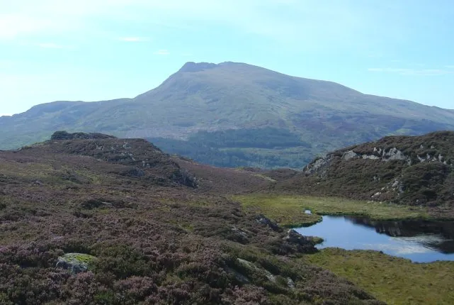
Moel Siabod
Photo via Wikimedia Commons — licence & author.
The best view OF Snowdon
This is a quick reference, not a full walked guide. The facts below — location, parking, grid reference and access — are maintained from our dataset, but we haven't published our own first-hand write-up of Moel Siabod yet. Know it well? Help us get it right.
Standing apart from the Snowdon crowds, Moel Siabod (872m) gives arguably the finest grandstand view of the entire Snowdon Horseshoe. The Daear Ddu east ridge is a gentle, brilliant introduction to scrambling, following the rim above a dark cwm lake. A good round goes up Daear Ddu and down the north-east ridge to Pont Cyfyng, with the Moel Siabod Café at Capel Curig waiting at the end. A proper mountain with none of the queues.
Getting there
Moel Siabod is in Capel Curig, Eryri (Snowdonia). It's roughly 9 min (2.1 miles) from Capel Curig , and within reach of Betws-y-Coed (19 min) and Beddgelert (25 min).
The nearest parking: Lay-bys at Pont Cyfyng, Capel Curig. Grid reference SH 718 560 — works on any OS map and doesn't need a phone signal.
Good to know
Up Daear Ddu, down the north-east ridge to Pont Cyfyng; pint at Y Stablau/Moel Siabod Café after.
On the map
View Moel Siabod on OpenStreetMap ↗, or open it in the Explore Wales trip planner to add it to a day out with drive times and offline maps.
Staying over?
Capel Curig makes a relaxed base for exploring the area — worth staying over to catch an early start or a golden-hour finish.
Browse places to stay near Capel Curig ↗ opens Booking.com — needs signalNearby places
Make Moel Siabod part of a day out
Add it to a trip in the free Explore Wales planner — chained drive times, weather, campsite suggestions, and offline maps for when the signal drops.