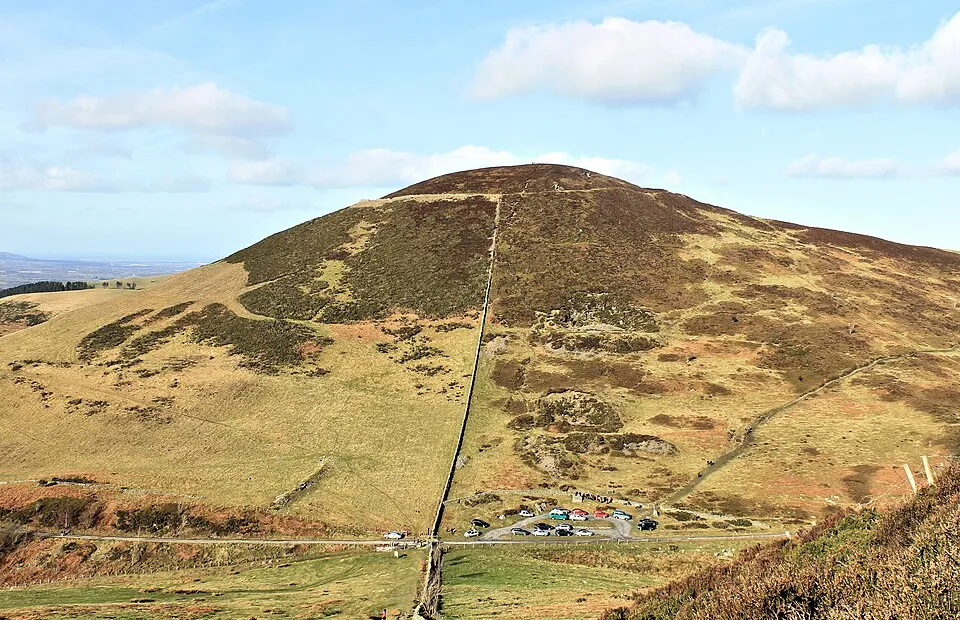
Moel Arthur Hillfort
Photo via Wikimedia Commons — licence & author.
Compact conical hillfort
This is a quick reference, not a full walked guide. The facts below — location, parking, grid reference and access — are maintained from our dataset, but we haven't published our own first-hand write-up of Moel Arthur Hillfort yet. Know it well? Help us get it right.
A small, almost perfectly conical hillfort defended by steep double ramparts — the shortest worthwhile hillfort climb in the Clwydians, about 25 minutes of sharp effort for a full 360-degree panorama over the Vale of Clwyd and out to the sea. Bronze Age axe hoards have been found on its slopes, a hint of how long this hill has mattered. It shares a car park with Penycloddiau, so the two forts pair naturally. Free and open, it's a local favourite for a quick sunset hit.
Getting there
Moel Arthur Hillfort is in Clwydian Range, North-East Wales. It's roughly 15 min (4.3 miles) from Ruthin , and within reach of Denbigh (18 min) and Holywell (24 min).
The nearest parking: Small free car park on the Llangwyfan–Nannerch lane below the fort. Grid reference SJ 139 653 — works on any OS map and doesn't need a phone signal.
Good to know
Shortest worthwhile hillfort hit in the Clwydians; great for a quick sunset.
On the map
View Moel Arthur Hillfort on OpenStreetMap ↗, or open it in the Explore Wales trip planner to add it to a day out with drive times and offline maps.
Staying over?
Ruthin has beautiful scenery, a castle and a very good bakery — what more could you ask of a base?
Browse places to stay near Ruthin ↗ opens Booking.com — needs signalNearby places
Make Moel Arthur Hillfort part of a day out
Add it to a trip in the free Explore Wales planner — chained drive times, weather, campsite suggestions, and offline maps for when the signal drops.