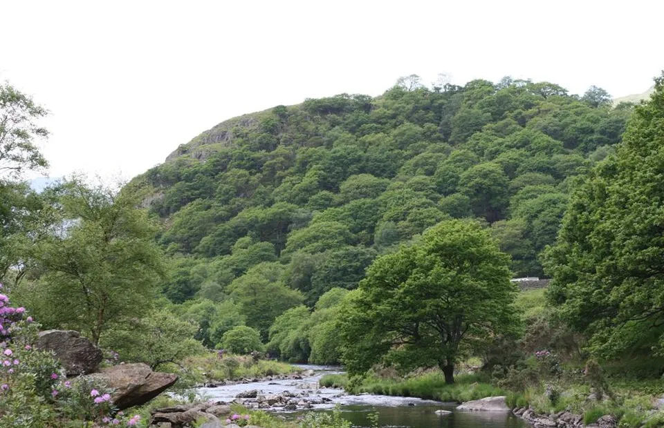
Dinas Emrys
Photo via Wikimedia Commons — licence & author.
Hillfort of the red dragon legend
This is a quick reference, not a full walked guide. The facts below — location, parking, grid reference and access — are maintained from our dataset, but we haven't published our own first-hand write-up of Dinas Emrys yet. Know it well? Help us get it right.
A wooded crag above Nant Gwynant steeped in legend: this is where the tale of Myrddin (Merlin) has two dragons — one red, one white — battling beneath a doomed tower, the red dragon's victory becoming the emblem of Wales. Archaeology confirms a real stronghold here from around the 5th century. The National Trust's waymarked route climbs from Craflwyn, a moderate walk of about two hours, and it's magical in autumn colour. Parking is at the NT's Craflwyn.
Getting there
Dinas Emrys is in Beddgelert, Eryri (Snowdonia). It's roughly 6 min (0.9 miles) from Beddgelert , and within reach of Llanberis (21 min) and Capel Curig (28 min).
The nearest parking: NT Craflwyn car park on the A498. Grid reference SH 587 495 — works on any OS map and doesn't need a phone signal.
Good to know
National Trust waymarked route from Craflwyn (moderate, ~2 hrs); magical in autumn colours.
🌟 Best time: The dragon's wood in full autumn colour — around October–November.
On the map
View Dinas Emrys on OpenStreetMap ↗, or open it in the Explore Wales trip planner to add it to a day out with drive times and offline maps.
Staying over?
Beddgelert makes a relaxed base for exploring the area — worth staying over to catch an early start or a golden-hour finish.
Browse places to stay near Beddgelert ↗ opens Booking.com — needs signalNearby places
Make Dinas Emrys part of a day out
Add it to a trip in the free Explore Wales planner — chained drive times, weather, campsite suggestions, and offline maps for when the signal drops.