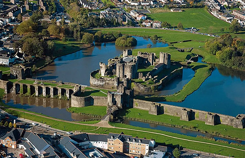
Caerphilly Castle
Photo via Wikimedia Commons — licence & author.
Britain's second-largest castle & its leaning tower
This is a quick reference, not a full walked guide. The facts below — location, parking, grid reference and access — are maintained from our dataset, but we haven't published our own first-hand write-up of Caerphilly Castle yet. Know it well? Help us get it right.
A colossal fortress begun around 1268 by the Anglo-Norman baron Gilbert 'the Red' de Clare — the first truly concentric castle in Britain, and at some 30 acres the largest in Wales and second only to Windsor in the whole country. Its genius is water: a chain of lakes and moats, held back by dams, wraps the walls in artificial islands that made assault almost impossible. The south-east tower leans dramatically out of true — further, they will happily tell you, than the Tower of Pisa — after subsidence and a Civil War slighting. Inside are a restored Great Hall and full-size working replica siege engines. It is Cadw-run in the middle of Caerphilly town; allow a couple of hours.
Getting there
Caerphilly Castle is in Caerphilly, South-East Wales. It's roughly 0 min (0 miles) from Caerphilly , and within reach of Cardiff (22 min) and Chepstow (66 min).
The nearest parking: Car parks in Caerphilly town centre by the castle. Grid reference ST 156 869 — works on any OS map and doesn't need a phone signal.
Good to know
Vast and moated; great for families and dragon-spotting (there are model dragons). The town is a short walk with cheese-and-caws heritage.
On the map
View Caerphilly Castle on OpenStreetMap ↗, or open it in the Explore Wales trip planner to add it to a day out with drive times and offline maps.
Staying over?
Caerphilly makes a relaxed base for exploring the area — worth staying over to catch an early start or a golden-hour finish.
Browse places to stay near Caerphilly ↗ opens Booking.com — needs signalNearby places
Make Caerphilly Castle part of a day out
Add it to a trip in the free Explore Wales planner — chained drive times, weather, campsite suggestions, and offline maps for when the signal drops.