Aberdaron
Photo via Wikimedia Commons — licence & author.
End-of-the-pilgrim-road village
This is a quick reference, not a full walked guide. The facts below — location, parking, grid reference and access — are maintained from our dataset, but we haven't published our own first-hand write-up of Aberdaron yet. Know it well? Help us get it right.
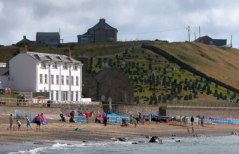
A whitewashed fishing village at the end of the old pilgrim road, where medieval travellers once waited for a fair crossing to Bardsey Island — with a mile-long beach and the ancient church of St Hywyn standing right at the sea's edge. It has a proper end-of-the-world feel. Y Gegin Fawr, the medieval pilgrims' kitchen, still serves crab sandwiches, and boat trips to Bardsey run in season from nearby Porth Meudwy. Parking is paid.
Getting there
Aberdaron is in Llŷn tip, Llŷn Peninsula. It's roughly 0 min (0 miles) from Aberdaron , and within reach of Abersoch (27 min) and Nefyn (36 min).
The nearest parking: NT car park in the village. Grid reference SH 172 265 — works on any OS map and doesn't need a phone signal.
Good to know
Y Gegin Fawr (the medieval pilgrims' kitchen) does crab sandwiches; boat trips to Bardsey run from Porth Meudwy.
On the map
View Aberdaron on OpenStreetMap ↗, or open it in the Explore Wales trip planner to add it to a day out with drive times and offline maps.
Staying over?
Aberdaron makes a relaxed base for exploring the area — worth staying over to catch an early start or a golden-hour finish.
Browse places to stay near Aberdaron ↗ opens Booking.com — needs signalNearby places
Make Aberdaron part of a day out
Add it to a trip in the free Explore Wales planner — chained drive times, weather, campsite suggestions, and offline maps for when the signal drops.