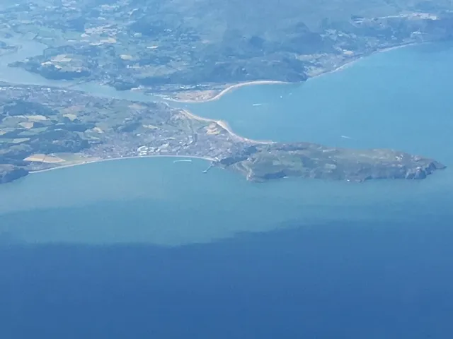
Great Orme
Photo via Wikimedia Commons — licence & author.
Limestone headland with Bronze Age mines
This is a quick reference, not a full walked guide. The facts below — location, parking, grid reference and access — are maintained from our dataset, but we haven't published our own first-hand write-up of Great Orme yet. Know it well? Help us get it right.
A great whale-back of limestone rearing above Llandudno — 'Y Gogarth' — ringed by the Marine Drive toll road and criss-crossed with walking trails. Beneath it lie the Great Orme Bronze Age Copper Mines, worked around 4,000 years ago and thought to be the largest prehistoric mine yet found anywhere in the world; you can walk down into the floodlit tunnels. Getting to the top is half the fun: the Victorian Great Orme Tramway, opened in 1902, is the only cable-operated street tramway still running in Britain, and a cable car climbs alongside it. Feral Kashmiri goats, descended from a royal gift, roam the headland, and seabirds nest on the sea cliffs. There is a summit visitor complex, a medieval church and huge views over the bay.
Getting there
Great Orme is in Llandudno, Conwy & the Coast. It's roughly 7 min (1.1 miles) from Llandudno , and within reach of Conwy (14 min) and Penmaenmawr (18 min).
The nearest parking: Summit car park, or park in town and walk/tram up. Grid reference SH 767 832 — works on any OS map and doesn't need a phone signal.
Good to know
Walk up via the zigzag Invalids' Path or take the vintage tramway; Marine Drive loop is superb at sunset.
On the map
View Great Orme on OpenStreetMap ↗, or open it in the Explore Wales trip planner to add it to a day out with drive times and offline maps.
Staying over?
Llandudno sits below the Great Orme, with a grand Victorian promenade to stroll and seafront hotels to match.
Browse places to stay near Llandudno ↗ opens Booking.com — needs signalNearby places



Make Great Orme part of a day out
Add it to a trip in the free Explore Wales planner — chained drive times, weather, campsite suggestions, and offline maps for when the signal drops.