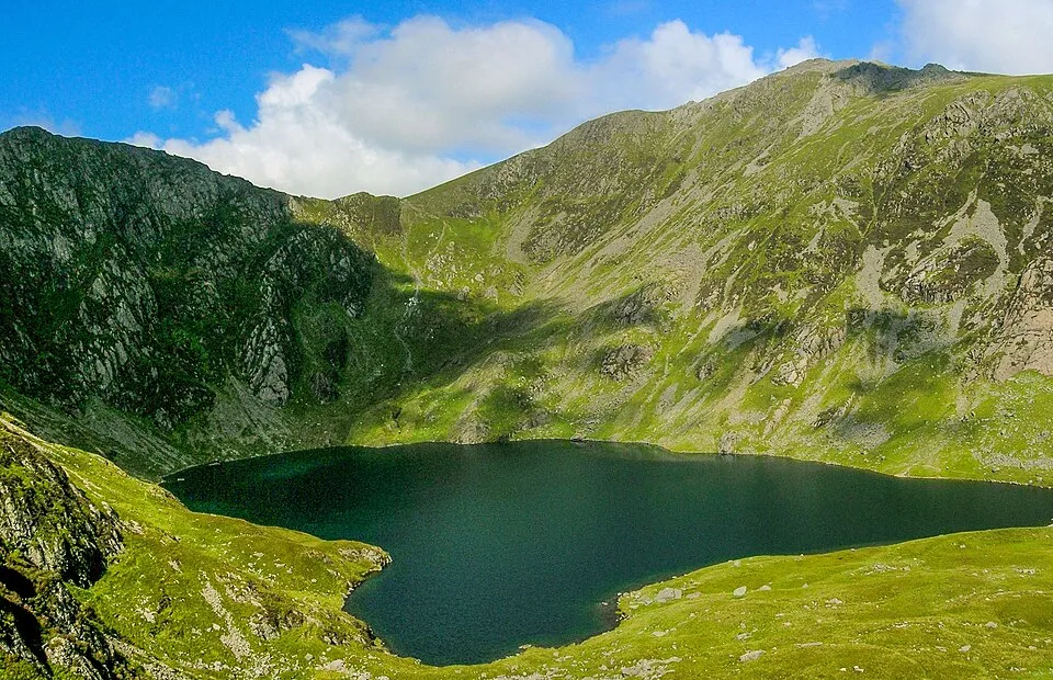
Cadair Idris
Photo via Wikimedia Commons — licence & author.
The 'Chair of Idris' — 893m of legend
This is a quick reference, not a full walked guide. The facts below — location, parking, grid reference and access — are maintained from our dataset, but we haven't published our own first-hand write-up of Cadair Idris yet. Know it well? Help us get it right.
A brooding mountain massif at the southern end of Eryri whose name means the 'Chair of Idris', cradling the dark glacial lake of Llyn Cau in one of the finest cwms in Wales. Legend says a night on its summit sends you home either a poet or a madman. The Minffordd Path, climbing past Llyn Cau, is the classic and steepest ascent — a full mountain day to the 893-metre top. The summit clags over fast, so check the forecast and carry what a real mountain demands. Parking is paid at Minffordd.
Getting there
Cadair Idris is in Southern Eryri, near Dolgellau, Mid Wales. It's roughly 12 min (3.1 miles) from Dolgellau , and within reach of Machynlleth (24 min) and Harlech (42 min).
The nearest parking: Pay-and-display at Dôl Idris (Minffordd Path), on the A487 south of Tal-y-llyn. Grid reference SH 776 089 — works on any OS map and doesn't need a phone signal.
Good to know
The Minffordd Path via Llyn Cau is the classic (and steepest) ascent — a full mountain day. Check the forecast; the summit clags in fast.
On the map
View Cadair Idris on OpenStreetMap ↗, or open it in the Explore Wales trip planner to add it to a day out with drive times and offline maps.
Staying over?
Dolgellau makes a relaxed base for exploring the area — worth staying over to catch an early start or a golden-hour finish.
Browse places to stay near Dolgellau ↗ opens Booking.com — needs signalNearby places
Make Cadair Idris part of a day out
Add it to a trip in the free Explore Wales planner — chained drive times, weather, campsite suggestions, and offline maps for when the signal drops.