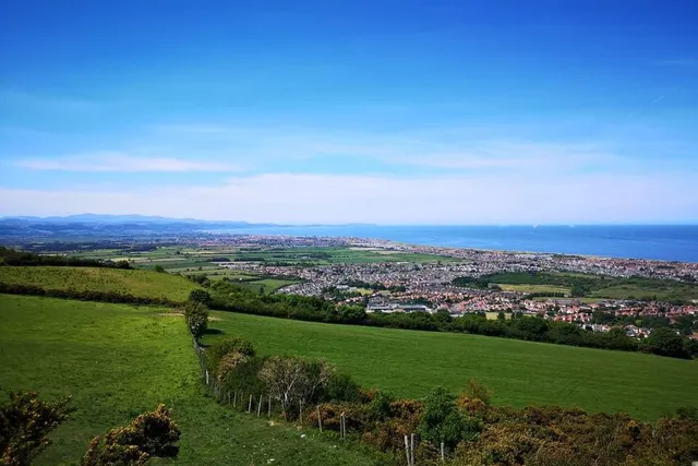
The Prestatyn–Dyserth Way
The gentlest outing in this guide: a dead-flat, traffic-free old railway line running below the hillside from Prestatyn to a twenty-metre waterfall. Bring bikes, pushchairs, grandparents — everyone finishes this one.
✅ Walked & checked: July 2026
Not every good day out needs a summit. This one trades climb for continuity: an unbroken green corridor along the bed of the old Dyserth branch railway, running below the limestone wall of Prestatyn Hillside to the door of Dyserth’s waterfall. It’s the route we recommend to visiting parents, recovering knees, and anyone with stabilisers.
The route, walked
Prestatyn end (0 km). Join the trackbed at the Fforddisa/Plas-y-nant entrance on the south edge of town (grid reference above; on-street parking nearby, or walk up from the town centre in ten minutes). The path announces itself with that unmistakable old-railway geometry: dead straight, tree-tunnelled, gently rising at a gradient designed for steam engines and therefore imperceptible to humans.
The middle miles (0–3.5 km). The hillside keeps pace on your left, all limestone scars and hanging woods; on your right, back gardens give way to sheep fields. Ivy-clad bridge abutments and a platelayers’ hut mark the railway’s ghosts. In June the verges are cow parsley head-high; in September, blackberries slow all progress by roughly half.
Dyserth end (4 km). The trackbed expires politely on the village edge, where signs point you two hundred metres to the falls. Pay your coin at the turnstile, feel twenty metres of the Afon Ffyddion on your face, and conduct the important ice-cream-versus-tea deliberation at the kiosk.
Return. Retrace — the reverse view of the hillside is arguably better — or, for walkers with legs left, climb through Dyserth to the National Trust’s Graig Fawr knoll and come back high along the hillside paths, turning the flat stroll into a proper loop with one big view per mile.
Practicalities
Free to use, open always, no stiles, dogs welcome (leads at road crossings, of which there are three). Surfaces are firm tarmac-and-gravel throughout — trainers, wheels and paws all fine year-round. Both ends have cafés and toilets in their towns; the route itself has neither, which is part of why it stays lovely.
Common questions
Is the Prestatyn–Dyserth Way suitable for pushchairs and wheelchairs?
Yes — it's a former railway trackbed with a firm surface and no stiles, one of the few genuinely step-free countryside routes on this coast. A couple of road crossings need care; gradients are railway-gentle throughout.
What's the history of the line?
It opened in 1869 to carry quarry stone and briefly passengers — a Victorian branch line whose commuters included quarrymen and seaside trippers. Trains stopped in 1973; the tarmac and trees moved in shortly after. Old platelayers' huts and bridge abutments still punctuate the route.
Does it go all the way to the waterfall?
The trackbed ends on the edge of Dyserth village, two minutes' walk from the falls — the finish line is effectively the turnstile and the ice-cream kiosk. Sustrans signage makes the link obvious.
Is it good for young cyclists?
It's the best beginner cycle route in the area: flat, fenced from traffic, with a waterfall and ice cream as the training incentive. The road crossings are the only supervision points.
Staying over?
Prestatyn is where Offa’s Dyke Path meets the sea, with plenty of camping and caravan options along the front.
Browse places to stay near Prestatyn ↗ opens Booking.com — needs signal